Tags: cities, city, country, czechoslovakia, czech republic, europe, map, mapa, mountain, prague, praha, river, state
Image License: CC0 No Rights Reserved
You can copy, modify, distribute and perform the work, even for commercial purposes, all without asking permission, and at no cost. This picture is completely free.
Map of the Czech Republic with main region's cities
by: petr-pavlicek based on molumen's map
This is a map of the Czech Republic, showcasing various cities and their locations. The map features rivers running through the country, with multiple blue lines indicating their paths. There are numerous orange dots scattered across the map, representing different cities within the region. Some of these cities include Prague, Brno, Ostrava, and Karlovy Vary. The map is a detailed representation of the Czech Republic's geography and urban centers.
This is a completely free image Map of the Czech Republic with main region's cities that you can download, post, and use for any purpose.
SVG files are the highest quality rendering of this drawing, and can be used in recent versions of Microsoft Word, PowerPoint, and other office tools.
Download as PNG File 571px x 322px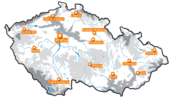
PNG files are the most compatible. Use this on your web page, in your presentation, or in a printed document.
Download as Word DocumentA Word document (docx) containing just the image. Ready to use in Microsoft Word, or LibreOffice.
Tags: cities, city, country, czechoslovakia, czech republic, europe, map, mapa, mountain, prague, praha, river, state
Image License: CC0 No Rights Reserved
You can copy, modify, distribute and perform the work, even for commercial purposes, all without asking permission, and at no cost. This picture is completely free.