Tags: request completed
Image License: CC0 No Rights Reserved
You can copy, modify, distribute and perform the work, even for commercial purposes, all without asking permission, and at no cost. This picture is completely free.
Tibet and its neighbors map
by: pjsvbfcm
This is a map of Asia, showing the countries and their borders. It includes countries such as India, China, Mongolia, Russia, and many others. Each country has its own color to distinguish it from the rest. The map also features various landmarks and cities, including Hong Kong, Beijing, Tokyo, and Delhi. Additionally, there are several flags displayed on the map, representing the countries' national symbols. Overall, this map provides a comprehensive view of Asia's geography and its various nations.
This is a completely free image Tibet and its neighbors map that you can download, post, and use for any purpose.
SVG files are the highest quality rendering of this drawing, and can be used in recent versions of Microsoft Word, PowerPoint, and other office tools.
Download as PNG File 563px x 420px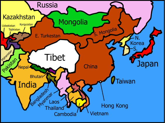
PNG files are the most compatible. Use this on your web page, in your presentation, or in a printed document.
Download as Word DocumentA Word document (docx) containing just the image. Ready to use in Microsoft Word, or LibreOffice.
Tags: request completed
Image License: CC0 No Rights Reserved
You can copy, modify, distribute and perform the work, even for commercial purposes, all without asking permission, and at no cost. This picture is completely free.