Tags: rivers, south africa, river
Image License: CC0 No Rights Reserved
You can copy, modify, distribute and perform the work, even for commercial purposes, all without asking permission, and at no cost. This picture is completely free.
Eastern Cape Map
by: Map2Map
This is a map of the Eastern Cape region in South Africa. It shows various towns and cities, including Port Elizabeth, East London, and Grahamstown. The map also includes rivers such as the Orange River and the Fish River. There are numerous dots on the map, which likely represent different locations or points of interest within the region. Overall, it is a detailed and informative map that provides valuable information about the Eastern Cape area.
This is a completely free image Eastern Cape Map that you can download, post, and use for any purpose.
SVG files are the highest quality rendering of this drawing, and can be used in recent versions of Microsoft Word, PowerPoint, and other office tools.
Download as PNG File 815px x 462px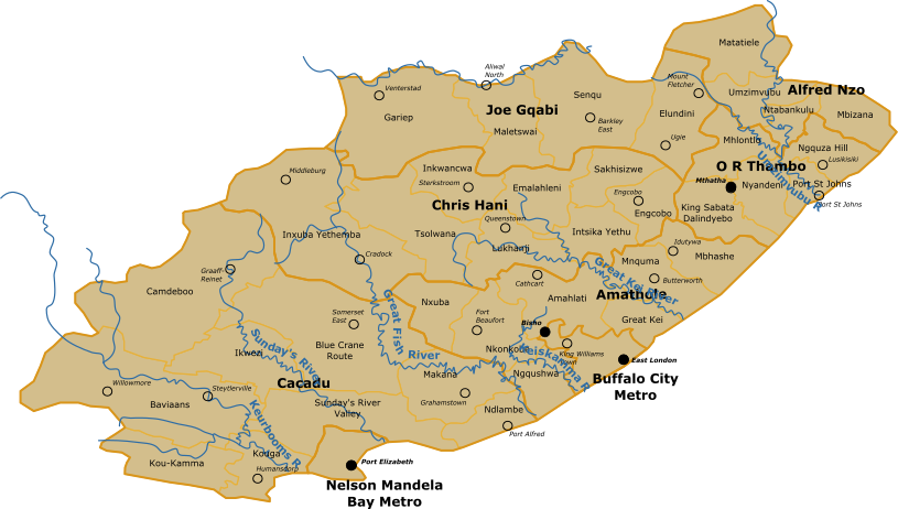
PNG files are the most compatible. Use this on your web page, in your presentation, or in a printed document.
Download as Word DocumentA Word document (docx) containing just the image. Ready to use in Microsoft Word, or LibreOffice.
Tags: rivers, south africa, river
Image License: CC0 No Rights Reserved
You can copy, modify, distribute and perform the work, even for commercial purposes, all without asking permission, and at no cost. This picture is completely free.