Tags: british, colony, district, empire, federated malay states, history, malaya, malaysia, protectorate, state, 1940
Image License: CC0 No Rights Reserved
You can copy, modify, distribute and perform the work, even for commercial purposes, all without asking permission, and at no cost. This picture is completely free.
Map of the Federated Malay States, 1940
by: derkommander0916
This is a map of the Federated Malay States, which was a British protectorate in Southeast Asia. The map shows the different states and districts within this region, with each state being colored differently to distinguish them from one another. There are several pink and orange states visible on the map, as well as some that are green or blue. The map is labeled with various names of the states and districts, making it easy for viewers to identify their locations. This map provides a clear visual representation of the Federated Malay States and its constituent parts.
This is a completely free image Map of the Federated Malay States, 1940 that you can download, post, and use for any purpose.
SVG files are the highest quality rendering of this drawing, and can be used in recent versions of Microsoft Word, PowerPoint, and other office tools.
Download as PNG File 1318px x 1562px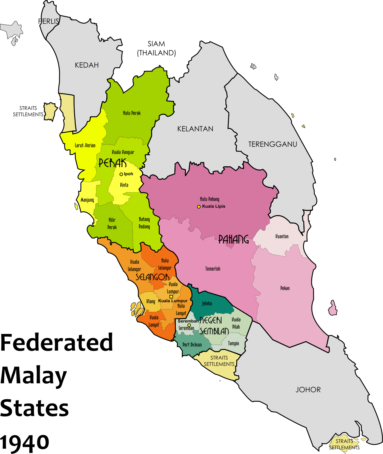
PNG files are the most compatible. Use this on your web page, in your presentation, or in a printed document.
Download as Word DocumentA Word document (docx) containing just the image. Ready to use in Microsoft Word, or LibreOffice.
Tags: british, colony, district, empire, federated malay states, history, malaya, malaysia, protectorate, state, 1940
Image License: CC0 No Rights Reserved
You can copy, modify, distribute and perform the work, even for commercial purposes, all without asking permission, and at no cost. This picture is completely free.