Tags: asia, british, colonial, colony, federated malay states, history, malaya, malaysia, map, maps of malaysia, protectorate, ww2, british malaya, colonial history, map of malaysia
Image License: CC0 No Rights Reserved
You can copy, modify, distribute and perform the work, even for commercial purposes, all without asking permission, and at no cost. This picture is completely free.
British Malaya Map 1939
by: derkommander0916
This is a political map of colonial Malaya in 1939. It shows the territories under British rule, including several states and settlements. The map is divided into different regions with various colors representing different territories. There are also labels indicating the names of some of these territories. This historical map provides insight into the political landscape of colonial Malaya during that time period.
This is a completely free image British Malaya Map 1939 that you can download, post, and use for any purpose.
SVG files are the highest quality rendering of this drawing, and can be used in recent versions of Microsoft Word, PowerPoint, and other office tools.
Download as PNG File 1319px x 1556px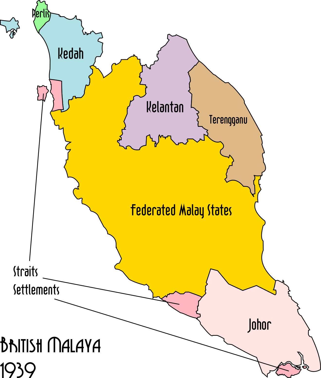
PNG files are the most compatible. Use this on your web page, in your presentation, or in a printed document.
Download as Word DocumentA Word document (docx) containing just the image. Ready to use in Microsoft Word, or LibreOffice.
Tags: asia, british, colonial, colony, federated malay states, history, malaya, malaysia, map, maps of malaysia, protectorate, ww2, british malaya, colonial history, map of malaysia
Image License: CC0 No Rights Reserved
You can copy, modify, distribute and perform the work, even for commercial purposes, all without asking permission, and at no cost. This picture is completely free.