Map of India, Tibet, Bhutan and Nepal

by: wpclipart

This is a map of the Indian Ocean, with several countries labeled on it. These include India, Bhutan, and Tibet. The map also shows the location of the ocean floor in relation to these countries. The countries are color-coded, with India being blue, Bhutan being red, and Tibet being green. The map is a useful tool for understanding the geographical relationships between these countries and their respective territories.

This is a completely free image Map of India, Tibet, Bhutan and Nepal that you can download, post, and use for any purpose.

Tags: bhutan, geography, location, india, tibet

Image License: CC0 No Rights Reserved
You can copy, modify, distribute and perform the work, even for commercial purposes, all without asking permission, and at no cost. This picture is completely free.

  Download Drawing as SVG File

SVG files are the highest quality rendering of this drawing, and can be used in recent versions of Microsoft Word, PowerPoint, and other office tools.

  Download as PNG File 456px x 501px

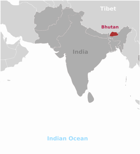
PNG files are the most compatible. Use this on your web page, in your presentation, or in a printed document.

Similar Clip Art Images
India Map
4  
Flag Map
2  
Europe Map
2  
Europe Map
2  
World Map
2  

Frequently Asked Questions

Is the Map of India, Tibet, Bhutan and Nepal clip art free to use?

Yes, this clipart is completely free to use, including for commercial purposes. You may use, distribute, or even sell this image without paying any royalties nor giving any credit. Because there is no fee attached to using the image, it's perfect for use in advertising and marketing materials, classrooms, and as part of your product.

Can I use this Map of India, Tibet, Bhutan and Nepal clip art in Microsoft Office?

Yes, this clip art is 100% compatible with Microsoft Office including Microsoft Word and PowerPoint. You can download this graphic as a high quality SVG file that scales to any size without becoming blurry. The SVG can then be imported into your office software whether that be Microsoft Office, Apple Pages, or LibreOffice.

Can I print the Map of India, Tibet, Bhutan and Nepal clip art?

Yes, this picture is suitable for printing, and will look great on posters, flyers, and handouts. These images scale without loss of quality, and will even look great on large-format posters and in high DPI.

Can I use Map of India, Tibet, Bhutan and Nepal on my website

Yes, you may download and use Map of India, Tibet, Bhutan and Nepal pic on your website. This image is compatible with Squarespace, Wix, WordPress, Webflow, and all the popular website publishing suites that allow for you to post pics.

About | Upload | Privacy Policy | Terms of Service
Copyright © 2024 WordMint LLC. All Rights Reserved.