GPS Signal Circular Illustration
by: tmjbeary
This depicts a complex network of GPS signals, with four satellites visible in the scene. These satellites are sending out signals that create a vortex-like pattern on the ground. Each satellite is represented by a different color, adding visual interest to the scene. The colors used for each satellite include orange, blue, green, and yellow, creating a vibrant and dynamic display of GPS technology.
This is a completely free image GPS Signal Circular Illustration that you can download, post, and use for any purpose.
Tags: dilution of precision, dop, gdop, geometric dilution of precision, gps, gps error, gps satellite, gps signals, satellite, satellite signals, gp, gps signal
Image License: CC0 No Rights Reserved
You can copy, modify, distribute and perform the work, even for commercial purposes, all without asking permission, and at no cost. This picture is completely free.
SVG files are the highest quality rendering of this drawing, and can be used in recent versions of Microsoft Word, PowerPoint, and other office tools.
Download as PNG File 193px x 241px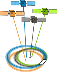
PNG files are the most compatible. Use this on your web page, in your presentation, or in a printed document.